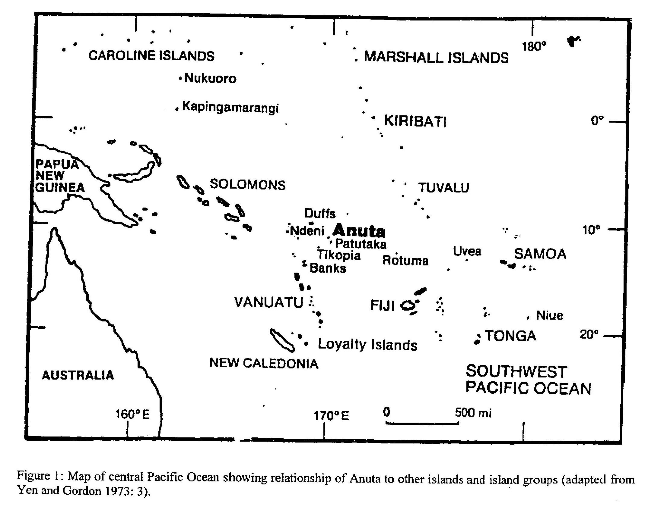
Anuta is a small volcanic outcropping in the Solomon Islands’ Temotu Province. It is the country’s easternmost populated island, located at approximately 169°50’ East and 11°40’ South. The nearest island of any appreciable size is a large, uninhabitable rock which Anutans call Patutaka, lying thirty nautical miles to the southeast; the nearest populated island, Tikopia, is about seventy five miles to the southwest.
Anuta has the shape of a slightly elongated circle. The island is volcanic in origin, with a rounded hill that rises 212 feet (65 m) above sea level (as measured by researchers Yen, Kirch, and Rosendahl). The island’s maximum diameter is a half mile, and its total surface area has been estimated (by Yen, Kirch, and Rosendahl) at .15 square miles (.39 square km). Considering these physical limitations, Anuta’s population size and ecological diversity are truly remarkable.
After Tikopia, the next nearest bits of terra firma are the Melanesian islands of Vanikoro, Utupua, and Nendö (Santa Cruz); the Reef Islands with their mixed Melanesian and Polynesian populations, and the Polynesian Duff Islands (Taumako), all over two hundred miles away. Further to the south and a bit west of Anuta are the Banks Islands of northern Vanuatu. To the east, the nearest island is Rotuma, five hundred miles away; beyond that are the Polynesian communities of ’Uvea and Futuna and the Tongan and Samoan archipelagoes. Between six and seven hundred miles to the northeast is Tuvalu (Ellice Islands), and about the same distance to the southeast lies Fiji.
(Adapted from Richard Feinberg, Anuta: Polynesian Lifeways for the 21st Century, Kent, Ohio: Kent State University Press, 2011, chapter 2.)